
Take the “Stairway to Heaven” to the Ötschergräben and Mariazell
By Reinhard Mandl
The Mariazellerbahn takes you right into the heart of the Ötscherland: Even the ride on the “Himmelstreppe” offers beautiful views. In the Ötschergräben, narrow footbridges lead past rushing streams, small waterfalls, and impressive rock formations. Add to that encounters along the way and ever-changing views of the Ötscher, the “Vaterberg” of the Mostviertel. To round off the trip, Mariazell awaits with its famous basilica before you head back home.
Through the Pielach Valley on the “Himmelstreppe”
Anyone who regularly travels on the western route has probably seen the gold-colored railcars bearing the inscription “Himmelstreppe” at St. Pölten Central Station. Since 2013, these eye-catching trains have been running on the Mariazellerbahn between St. Pölten and Mariazell. This narrow-gauge railway is operated by Niederösterreich Bahnen, and since it’s also part of the Verkehrsverbund Ost-Region (VOR), the KlimaTicket Ö is valid here as well.
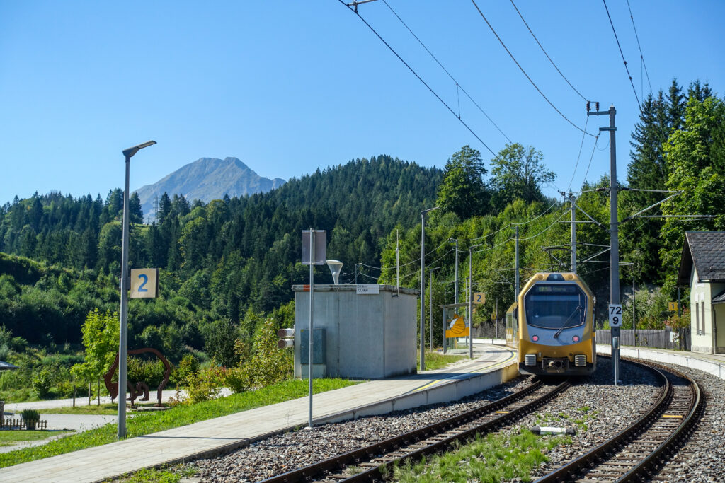
The conductor of the “Himmelstreppe” stands on the platform and greets each passenger personally. Instead of the usual detached railway routine, I’m treated to a friendly smile here, which further fuels my anticipation for the ride. The bit of morning fog can’t change that—it’ll soon vanish into thin air.
The “Himmelstreppe” is surprisingly modern. Onboard monitors keep us informed about the route and provide live footage from a camera at the rear of the train. But I find “looking out the train window live” even more exciting: We’ve just pulled into the St. Pölten Alpine Station, the new hub of NÖVOG, the Lower Austrian Transportation Organization. This is also where the historic trains used on the various Lower Austrian rail lines are maintained. Several old locomotives are parked on sidings.
In the meantime, we’ve rolled quietly along the tracks from the Traisen Valley into the Pielach Valley, the “Dirndl Valley.” If you’re thinking of traditional folk costumes, you’re mistaken: here, “Dirndln” also refers to the fruits of the cornel cherry, which thrive particularly well in the Pielach Valley. In honor of this fruit—which is used, among other things, to make delicious jams—the Dirndlkirtag festival takes place every September, and of course, many women attend wearing dirndl dresses!
The Ötscher is getting closer
Sitting across from me is a man in his mid-forties who, as he tells me, goes hiking in the Ötscher region ten times a year. Today he’s heading from Mitterbach to the Gemeindealpe, one of the most popular scenic peaks in the Mariazell region. Curious, I ask my seatmate which hike he would recommend to a newcomer to the area. “The best thing to do is to drive to Wienerbruck-Josefsberg and walk down through the Ötscher-Basis Nature Park Information Center into the Ötschergräben. At Ötscher-Hias, after about an hour and a half of walking, you’ll have to decide whether to head back the same way or take a loop through the Hagen Forest Estate to the Erlaufklause train station,” my seatmate explains. That’s exactly what I had in mind anyway!
The mountainous part of the route begins at Laubenbachmühle. A modern operations center for the Mariazellerbahn has been built here, where the railcars of the “Himmelstreppe” fleet are repaired and maintained. The ride from Laubenbachmühle up to the Winterbach station takes 13 minutes. Given the elevation gain of nearly 200 meters, that’s quite an achievement. Winterbach lies 719 meters above sea level. However, this isn’t yet the highest point on the Mariazellerbahn route—which was originally called the Lower Austrian-Styrian Alpine Railway. That point is located in the middle of the Gösing Tunnel at just under 900 meters above sea level.
No sooner had we left this gloomy hole than it suddenly loomed before us: mighty and towering—the Ötscher! Given this impressive view, I’m not surprised that a hotel was built here. Recently, however, this 100-year-old, historic hotel was closed.
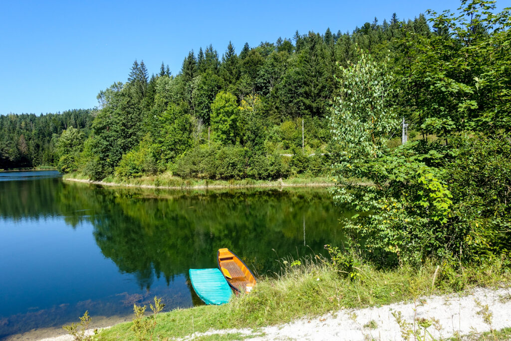
I get off the train at the Wienerbruck-Josefsberg stop. The station building has been beautifully renovated, but has been privately owned since 2014. Today, it houses two vacation apartments overlooking a small reservoir. The power of this water is used down in the valley to generate electricity for the Mariazellerbahn. Just a few steps from the train station is the Ötscher-Basis Nature Park Center. This multifunctional wooden building not only provides information about the Ötscher-Tormäuer region, but also houses a shop and a restaurant. It’s also a perfect starting point for hikes.
At the gateway to the Ötschergräben
At first, the trail runs along the southern shore of the reservoir on level ground; then the Waldmarkweg leads along the Lassingbach into lower-lying areas. After 20 minutes, I reach a footbridge that spans the mountain stream at a dizzying height. Just before that, a steep trail branches off to the right toward the Kaiserthron. This strenuous detour takes me in just under a quarter of an hour to a hilltop that offers a view deep into the Ötschergräben. It took the Ötscherbach many millennia to carve out this valley, though it’s not visible from up here. In contrast, the Wienerbruck power plant—built between 1908 and 1911 to enable the electrification of the Mariazellerbahn—was a visionary feat, as never before had such a long railway line been powered by electricity!
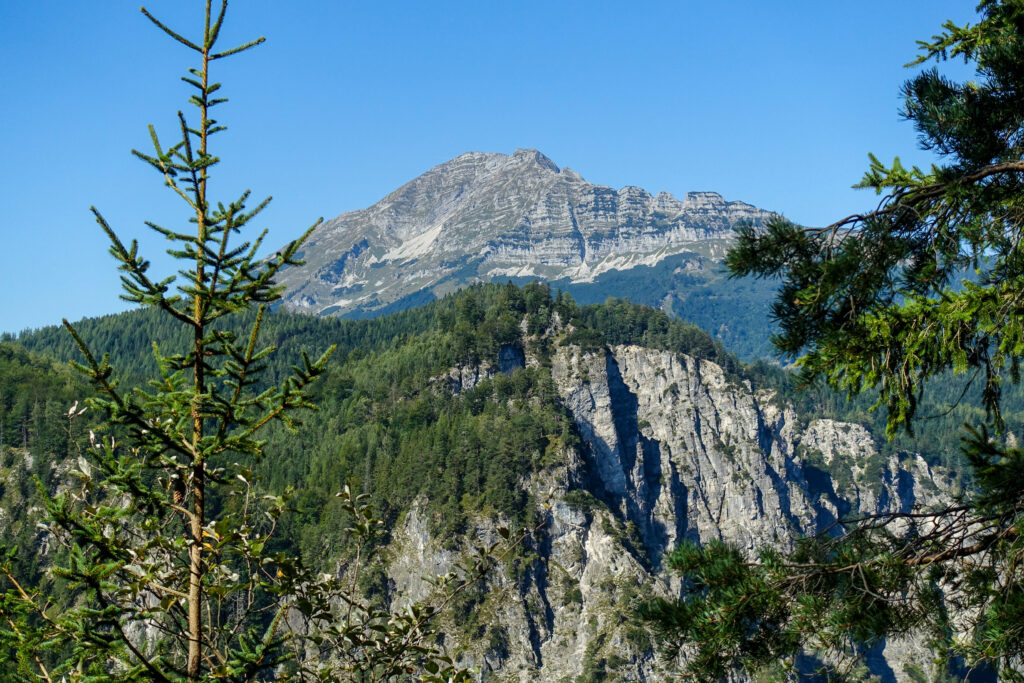
What I can also see from the Kaiserthron is the highest mountain in Lower Austria’s Mostviertel region, the Ötscher. Its name is derived from the Celtic word “ocan,” which is why it is nicknamed “Vaterberg” (Father Mountain). From where I stand, I can only see its narrow side. From this perspective, the Raue Kamm—the east ridge ascent to the 1,893-meter-high Ötscher—is particularly impressive.
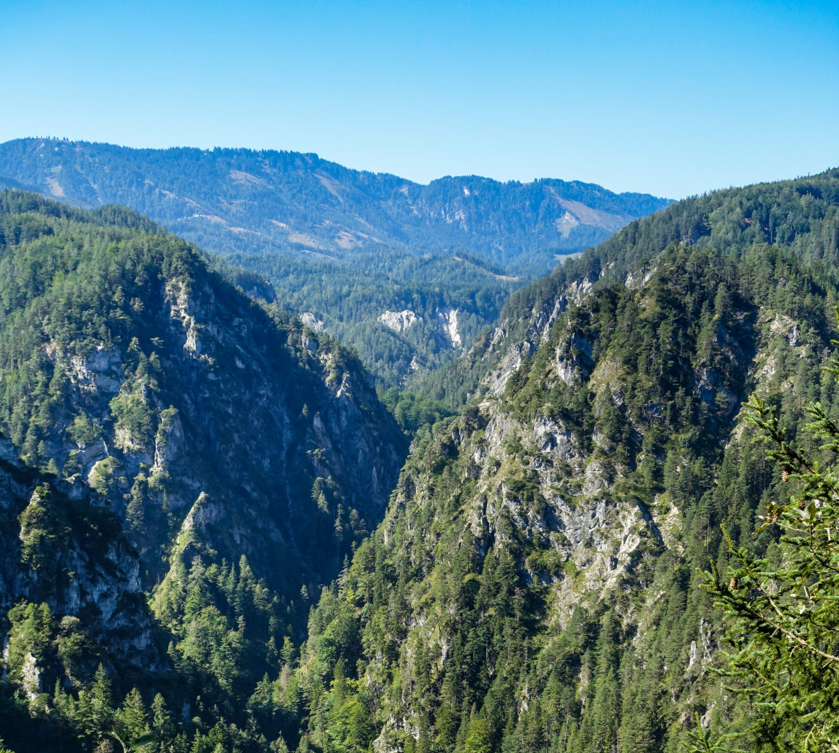
With a queasy feeling, I head back down the same steep trail. An information sign warns of the danger of falling rocks and falls. In bad weather, hiking this alpine trail is prohibited. Down at the trailhead, however, these warnings are nowhere to be found.
The well-secured trail down to the Wienerbruck power plant leads through several picturesque rock passages. In a good quarter of an hour, I’m down at the Stierwaschboden. Not far from where the Ötscherbach flows into the Erlauf stands the Wienerbruck power plant, which is also open to visitors.
Through the “Ötschergräben”
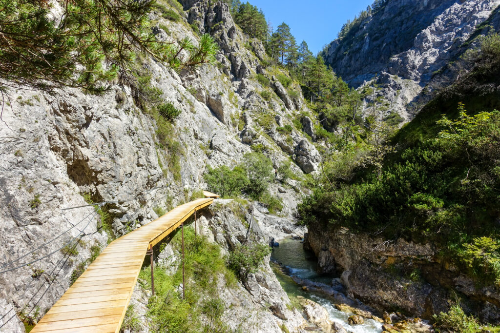
I now cross the Ötscherbach on a wooden bridge and keep to the left. This is where the Ötschergräben begin. The term “Ötschergraben” would be more accurate, as it is simply a deeply incised ravine that stretches for about six kilometers. However, the most frequently hiked section—from Stierwaschboden to Ötscherhias—has come to be known as the “Vordere Ötschergräben” (Front Ötscher Gorges) to better distinguish it from the rear section extending to Schleierfall, which is called the “Hintere Ötschergräben” (Rear Ötscher Gorges).
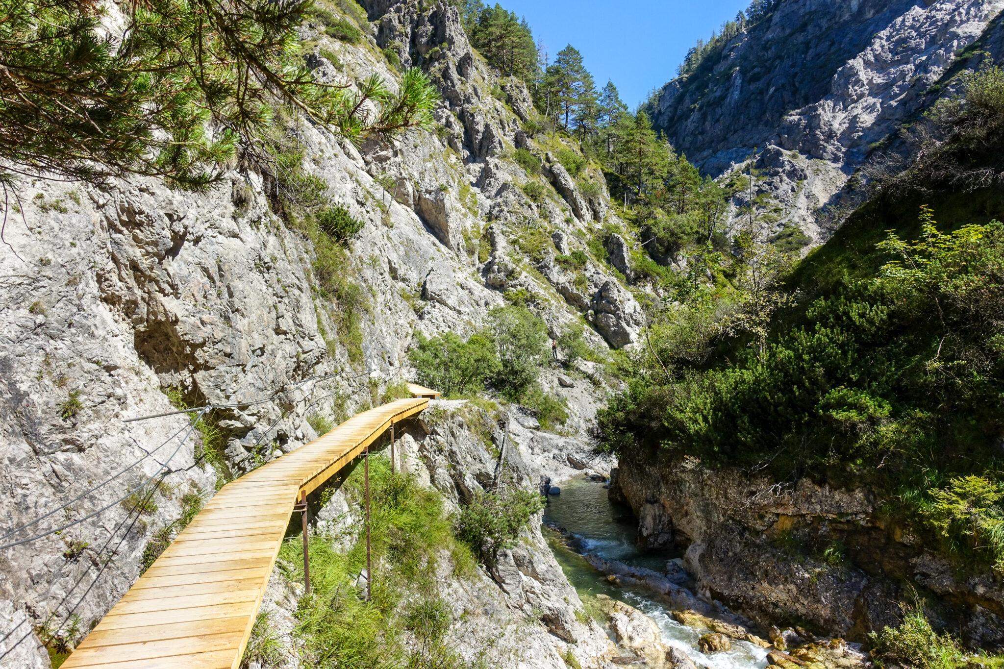
A very long time ago, this once completely impassable area was opened up by lumberjacks and cattle herders working on behalf of Lilienfeld Abbey. Today’s well-maintained hiking trail traces its origins back to this pioneering work. Time and again, I cross from one bank of the Ötscherbach to the other via narrow wooden footbridges. The valley carved out by the stream is considered one of the Alpine region’s foremost natural treasures due to its beauty and seclusion. Nevertheless, I consider the description of the Ötschergräben as the “Grand Canyon of Austria” to be exaggerated and misleading.
My path along the Ötscherbach leads past small waterfalls. Time and again, I come across sunny coves where hikers cool their feet in the green, clear mountain water. The particularly daring even take a refreshing dip. I also find the many shaded sections along my path pleasantly cool. Despite their low elevation, the Ötscher Gorges have a distinctly alpine character. The predominant rock—Ramsaudolomite—is particularly brittle and weathers into bizarre rock formations. It consists of the remains of organisms from tropical shallow seas, as I later read in Werner Gamerith’s book *Ötscherland*.
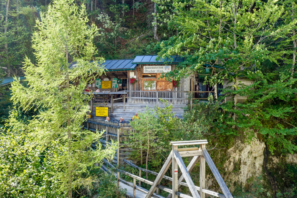
Soon, the quaint Ötscherhias snack bar—built in 1938—comes into view; it’s accessible via a footbridge. Over some bread with lard and a beer, I hatch a plan: I’ll head back the same way and check out the Vorderen Ötschergräben from the opposite direction as well. At 2:32 p.m., I try to catch the train to Mariazell in Wienerbruck. I’ll save the Hintere Ötschergräben—which pass by the Mirafall and Schleierfall waterfalls—for a later outing.
I’m moving along at a pretty brisk pace, and yet I suddenly hear footsteps behind me. It’s a trail runner who’s passing me. Just ahead of me, he stops at a fork in the trail to get his bearings. “Where did you start?” I ask him. “In Lackenhof—I ran over the Ötscher and the Rauen Kamm into the Gräben,” he explains. This extreme athlete has already been on the go for nearly six hours. His high-tech watch also shows him the distance he’s covered: 29 kilometers! “And how much further are you going?” His astonishing answer: “Well, back to Lackenhof again—I’m circling the Ötscher!” In total, he’ll cover around 60 kilometers—unbelievable!
In comparison, my hike along the Ötschergräben is just a short walk, even though I’ve already been on the trail for nearly four hours.
By train to the place of mercy
The train is on time. During the short ride to the Mariazellerbahn’s terminal station, I let off some steam. This railway line owes its existence not to freight traffic, but to the seemingly endless stream of pilgrims who made their way to Mariazell—especially in the 19th century, during the Austro-Hungarian Empire: first on foot, then by train, and later by bus and in their own cars. Recently, pilgrimages on foot have become popular again, as has traveling by train on the modern Mariazellerbahn, which in its heyday ran up to 25 trains a day, bringing 10,000 pilgrims to the shrine.
The flower-adorned Mariazell train station, which is scheduled for extensive renovation in 2024, is located about a 20-minute walk from the famous basilica. I’m lucky and catch the bus to Kapfenberg, which takes me the rest of the way to the bus station in the city center. I tell the driver that I have a KlimaTicket; I don’t have to show it to him—he just takes my word for it.
Arriving here on foot, along one of the many Mariazell trails that lead here from all directions, is probably a particularly uplifting feeling. But even the first glimpse of the basilica’s three towers through the bus’s large windshield is an experience. Upon closer inspection, however, a sense of disillusionment sets in: too many cars surrounding the church, too much hustle and bustle, and too little serenity. In front of the steps, I meet a pilgrim in traditional Styrian attire. He’s from Köflach and has been walking for three days.
I enter the Habsburg main sanctuary and walk up to the Chapel of Grace. The small statue of the Virgin Mary with the Infant Jesus, carved from linden wood, is surrounded by splendor and gold. She is the Magna Mater Austriae—Great Mother of Austria—and at the same time the Magna Hungarorum Domina—Great Lady of Hungary—as well as the Mater Gentium Slavorum—Mother of the Slavic Peoples.
In the candle chapel behind the church, I light a candle; then I pick up that famous Mariazell stomach liqueur, which has served our family well for decades, and some original Mariazell honey gingerbread as a souvenir. I had actually planned to go out for a meal in Mariazell as well, but that’s not going to happen. On the way to the train station, I quickly stock up on some travel provisions at a supermarket: two warm Leberkäs sandwiches and a cold beer. The conductor wishes me bon appétit, and I enjoy my meal while outside the train window the landscape of the Ötscherland glows in the last light of the evening sun.
This text is an abridged version, edited by the author, of Chapter 3 of his book Discover Austria with the KlimaTicket—20 Trips by Bus and Train.